Categories: Collaboration Platforms, Data Management, Reality Capture
Vercator is a cloud platform to quickly process your point cloud data.
Vercator’s registration service automatically aligns point cloud data without artificial scan targets. Powerful, fast and interoperable, register large, complex point cloud data with minimal intervention, saving you valuable time and resources.
Vercator classification extracts automated insight from point cloud data by separating data into different classes of interest and individual instances. This allows insight into assets in your scene allowing for quick understanding and data extraction for downstream modelling
0
People watching this product now!
Key Information
Discipline | , |
---|---|
Deployment | |
Project Phase | , , |
Free Trial |
Yes |
Vendor | |
Integrations |
BLK ,E57 ,FLS ,LAS ,LAZ ,PLY ,PTS* ,PTX* ,RDBX ,RTC360 ,ZFS |
What is Vercator used for?
Vercator is a cloud based point cloud processing tool. Data can be captured, processed, and shared with effortless flexibility and speed.
Registration:
Automatically align targetless point cloud data without sacrificing accuracy or speed. Deliver robust point cloud registration across multiple sensor types — from drones to static scanners and SLAM-based robots — and create hybrid data sets.
Save time in the field and at the office, and get a single, secure and reliable place for all of your data.
Classification:
Classification allows you to extract insights and identify objects within uniform point cloud datasets for downstream tasks. Vercator automates classification at speed and at scale by harnessing the potential of point clouds in the cloud. Get accurate results faster, no matter the size of the project.
Alternative Products
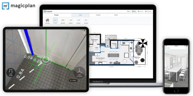
Magicplan
Magicplan is a mobile application (iOS and Android) that lets users quickly generate floor plans using the camera on their smartphone or tablet. It leverages augmented reality (AR) technology to capture room dimensions, lets you add objects like furniture or fixtures, and can generate 2D and 3D floor plans, including reports, estimates, and 360-degree panoramas.