


Alternative Products


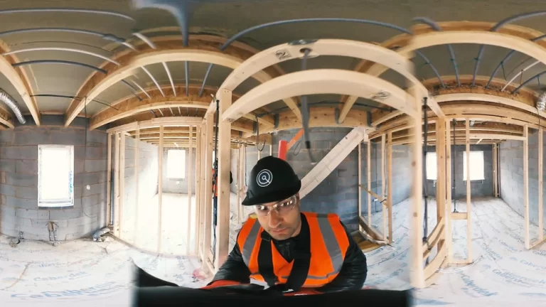
OpenSpace
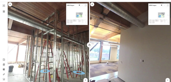
OpenSpace is a reality capture and AI-powered analytics platform for construction. It uses 360° cameras mounted on hard hats to automatically capture job site progress, creating a digital twin of the project. The platform then uses AI to analyze these images, providing insights into progress tracking, quality control, safety monitoring, and issue identification.
OpenSpace helps construction teams improve communication, reduce rework, and make data-driven decisions to keep projects on time and within budget.

SiteSee
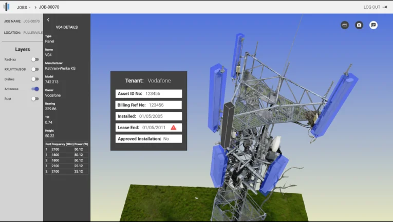
SiteSee is an Australian company focused on creating AI-powered digital twins for infrastructure within the power and telecommunications sectors.expand_more Their platform transforms traditional asset data along with site imagery (photos and videos) into highly accurate and information-rich digital representations of infrastructure like towers and transmission lines.expand_more This digital twin technology allows for remote inspections, virtual collaboration, and data-driven insights on asset health.expand_more SiteSee aims to revolutionize asset management in these sectors by making it faster, more efficient, and safer.expand_more

Magicplan
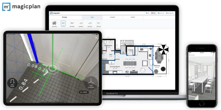
Magicplan is a mobile application (iOS and Android) that lets users quickly generate floor plans using the camera on their smartphone or tablet. It leverages augmented reality (AR) technology to capture room dimensions, lets you add objects like furniture or fixtures, and can generate 2D and 3D floor plans, including reports, estimates, and 360-degree panoramas.

OnSite IQ
OnSiteIQ is a construction intelligence platform that helps real estate owners, developers, and investors gain visibility into their projects. The platform uses 360° image capture, powered by computer vision, to document construction progress throughout the entire lifecycle. OnSiteIQ offers features like automated progress tracking, issue identification, as-built documentation, and remote site monitoring. The software aims to provide real-time insights, helping stakeholders make informed decisions, streamline collaboration, and mitigate risk within their construction portfolios.

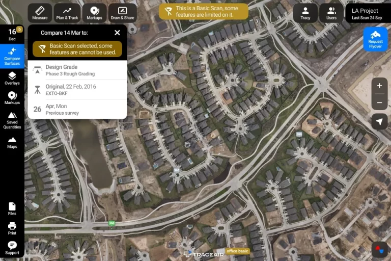
TraceAir
TraceAir is a construction site analysis and management platform that leverages drone data to simplify workflows and enhance project efficiency. The platform enables drone surveys to create accurate 3D topographical models of the site. Users can then overlay design documentation to compare as-built conditions with the intended design, track earthwork progress using cut/fill calculations, visualize stockpiles, manage site logistics, and collaborate easily with project stakeholders, all from a centralized web-based platform.