TraceAir

TraceAir is a construction site analysis and management platform that leverages drone data to simplify workflows and enhance project efficiency. The platform enables drone surveys to create accurate 3D topographical models of the site. Users can then overlay design documentation to compare as-built conditions with the intended design, track earthwork progress using cut/fill calculations, visualize stockpiles, manage site logistics, and collaborate easily with project stakeholders, all from a centralized web-based platform.

0 People watching this product now!

Key Information

Discipline

,

Deployment

Project Phase

,

What is TraceAir used for?

TraceAir is a cloud-based software platform specifically designed for construction site analysis and management using drone data. Here's a breakdown of its key functionalities:

Drone Data Integration:

TraceAir allows users to upload data captured by drones performing aerial surveys of the construction site. This data is typically in the form of high-resolution photos and point clouds (dense sets of 3D coordinates representing the site's topography).

3D Topographical Modeling:

Using the drone data, TraceAir generates a highly accurate 3D digital model of the construction site's existing terrain. This model provides valuable insights into site conditions, volumes of earthwork required, and progress tracking.

Cut/Fill Calculations:

TraceAir facilitates earthwork calculations by allowing users to compare the existing site topography with the design plans for the finished project. This helps determine the amount of soil that needs to be excavated (cut) or brought in (fill) to achieve the desired final grades.

Progress Tracking and Monitoring:

3D models and data visualization tools help track construction progress visually, compare it to the schedule, and identify potential delays or areas requiring adjustments.

Improved Site Communication & Decision-Making:

TraceAir facilitates communication by providing a shared data platform for project teams. This enables better decision-making based on real-time data and progress updates.

Alternative Products

Canvas

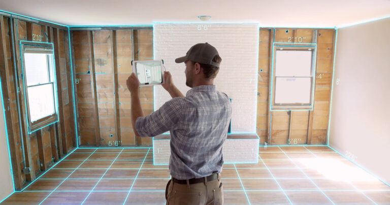
Canvas is a service that creates "editable, layered as-built models" for remodelers, architects, interior designers, and construction professionals. It uses reality capture technologies to document existing conditions and then integrates that data with design models (BIM). Essentially, Canvas drafts digital models of existing buildings, which can then be used for renovations, redesigns, or other construction projects.

Air Go

Effortless Virtual Sites. Visualise your construction virtual site in 360° anytime, anywhere. Traverse to any moments in your project like a time capsule.

Imerso

Imerso AI analyses construction quality and progress directly against your building plans, so your teams can build faster with less risk.

OpenSpace

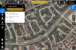
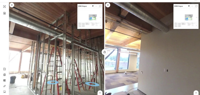
OpenSpace is a reality capture and AI-powered analytics platform for construction. It uses 360° cameras mounted on hard hats to automatically capture job site progress, creating a digital twin of the project. The platform then uses AI to analyze these images, providing insights into progress tracking, quality control, safety monitoring, and issue identification. OpenSpace helps construction teams improve communication, reduce rework, and make data-driven decisions to keep projects on time and within budget.
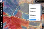
SiteAware

SiteAware is a digital construction verification platform that uses AI and 3D scanning to help construction teams ensure that their projects are built exactly as planned. It automatically identifies discrepancies between the building plans and the actual construction in real-time, allowing teams to correct errors before they become costly problems. This helps reduce rework, improve accuracy, and keep projects on schedule and within budget.