


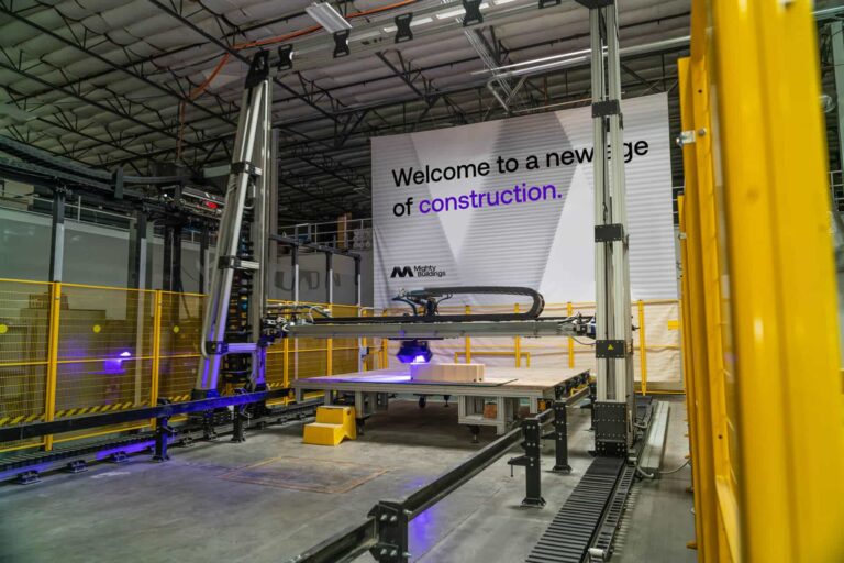
Mighty Buildings
Mighty Buildings is a company that creates 3D-printed complete wall systems. Their two main products are the MKS 2.0, which connects to a superstructure and can adapt to any design, and the MKS BASE, a load-bearing panel that is easily adopted for residential construction.
Mighty Buildings focuses on sustainability and has been recognized for its innovative and green technology.
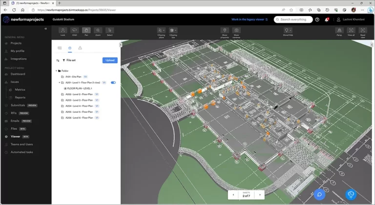
Newforma Konekt
Newforma Konekt is a cloud-based project information management (PIM) platform designed specifically for the Architecture, Engineering, and Construction (AEC) industry. It centralizes project files, acts as a single source of truth for documents, facilitates collaboration between stakeholders, automates workflows, and gives insights into construction progress by integrating with field applications – all with a goal of improving overall project efficiency, communication, and transparency.
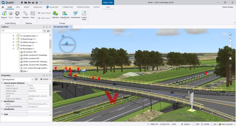
NovaPoint
Novapoint is a software suite developed by Trimble Solutions Corporation, primarily used in the civil engineering and infrastructure industries. Novapoint offers a range of tools and modules for various aspects of road and railway design, as well as for urban planning and land development projects. Novapoint includes modules for tasks such as road and highway design, terrain modeling, drainage design, and traffic analysis. It allows engineers and designers to create detailed 3D models of infrastructure projects, analyze design alternatives, and optimize designs for factors such as safety, efficiency, and sustainability.
One of the key features of Novapoint is its integration with other software platforms and industry standards. It supports interoperability with BIM (Building Information Modeling) workflows, enabling seamless collaboration with other design disciplines and software platforms. Novapoint also integrates with GIS (Geographic Information Systems) data, allowing users to incorporate geospatial information into their designs.

OnSite IQ
OnSiteIQ is a construction intelligence platform that helps real estate owners, developers, and investors gain visibility into their projects. The platform uses 360° image capture, powered by computer vision, to document construction progress throughout the entire lifecycle. OnSiteIQ offers features like automated progress tracking, issue identification, as-built documentation, and remote site monitoring. The software aims to provide real-time insights, helping stakeholders make informed decisions, streamline collaboration, and mitigate risk within their construction portfolios.

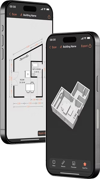
Opal AI
Opal AI is an AI solutions provider that specializes in turning various types of data (spatial, visual, textual, and audio) into actionable insights, primarily through the creation of 2D and 3D models. They offer services like Scan to BIM, where they use AI to generate building information models from 3D scans, and Scanto3D, a mobile app for real-time 2D and 3D CAD model creation.

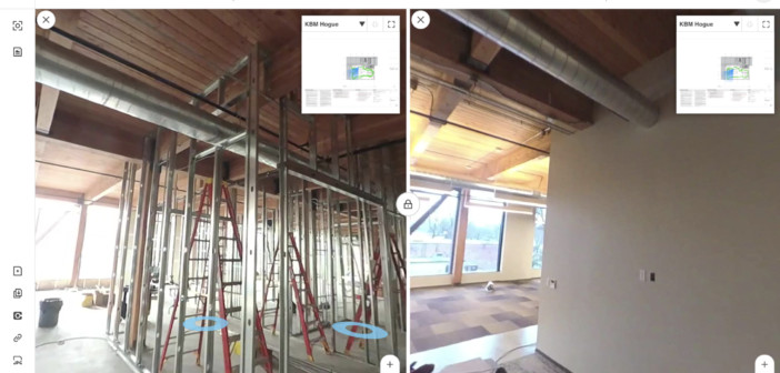
OpenSpace
OpenSpace is a reality capture and AI-powered analytics platform for construction. It uses 360° cameras mounted on hard hats to automatically capture job site progress, creating a digital twin of the project. The platform then uses AI to analyze these images, providing insights into progress tracking, quality control, safety monitoring, and issue identification.
OpenSpace helps construction teams improve communication, reduce rework, and make data-driven decisions to keep projects on time and within budget.

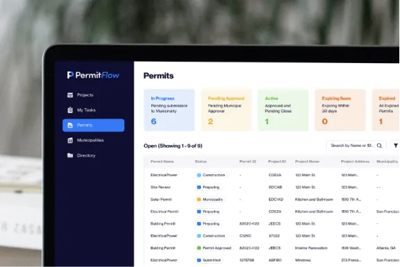
Permit Flow
Permit Flow is a software platform designed to streamline the often complex and time-consuming process of obtaining construction permits. It provides a centralized system for managing all aspects of permitting, from application submission and tracking to communication with municipalities and document management.
Permit Flow aims to simplify the permitting process by automating tasks, providing real-time updates on permit status, and facilitating communication between contractors, architects, and permitting agencies, ultimately helping projects stay on schedule and avoid costly delays.
ProjectReady
ProjectReady provides a modern and scalable collaborative project information management solution that brings data and information together to save time, reduce risk, and save money. Our unique approach to collaborative project information management, rooted in the concept of an integrated data environment:
– Makes project data and information easily accessible across a variety of platforms and systems.
– Applies automation and governance to system integration.
– Reduces labor costs, delays, re-work, budget overruns, safety issues, and the likelihood of litigation.

Red Team
Red Team is a cloud-based construction project management software that simplifies the entire project lifecycle. From bidding and estimating to document management and change orders, it streamlines workflows for teams by offering features like collaborative bidding tools, mobile access for field crews, and real-time project tracking. This promotes better communication, improves efficiency, and helps construction companies stay on budget and schedule.
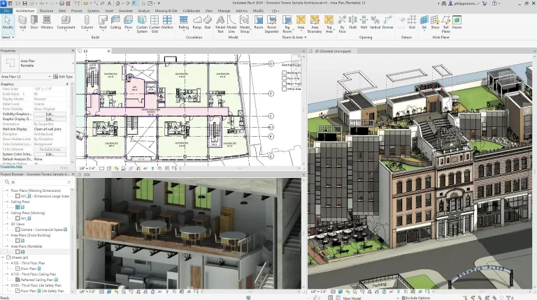
Revit
Revit is a Building Information Modeling (BIM) software developed by Autodesk. It’s widely used in the architecture, engineering, and construction (AEC) industry for designing and documenting building projects. Revit allows users to create 3D models of buildings and their components, such as walls, floors, roofs, and structural elements.
SiteAware
SiteAware is a digital construction verification platform that uses AI and 3D scanning to help construction teams ensure that their projects are built exactly as planned. It automatically identifies discrepancies between the building plans and the actual construction in real-time, allowing teams to correct errors before they become costly problems. This helps reduce rework, improve accuracy, and keep projects on schedule and within budget.
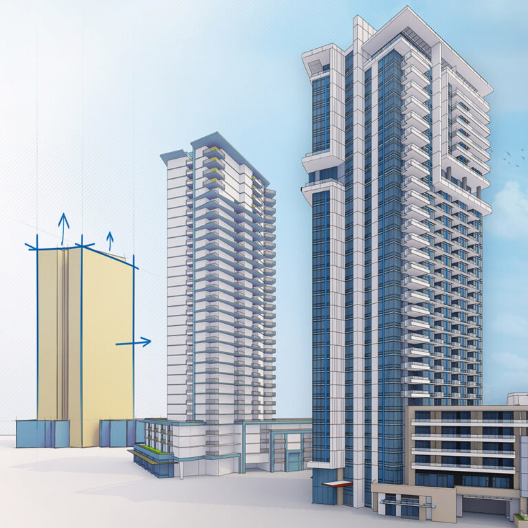
SketchUp
SketchUp is a 3D modeling software widely used in architecture, interior design, landscape architecture, and related fields.It allows users to create 3D models of buildings, interiors, furniture, landscapes, and other objects using a combination of drawing tools, push-pull modeling, and a vast library of pre-made components.