


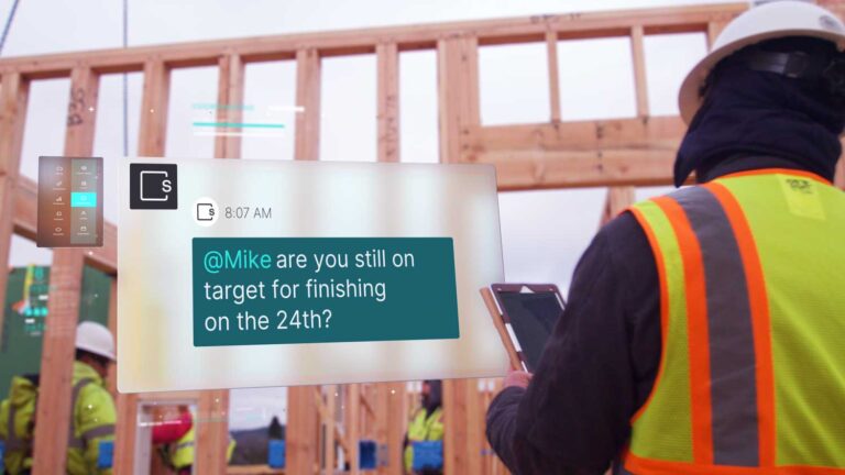
Slate
Slate is an AI-powered data analytics platform that helps construction teams make better decisions by providing them with real-time, data-driven insights. Slate’s solutions were built to solve real world construction problems, from real estate investment and pre-construction to construction and delivery. Slate’s AI-powered data analytics software leverages predictive AI alongside generative AI & conversational AI to deliver a powerful toolkit for next generation construction. 1

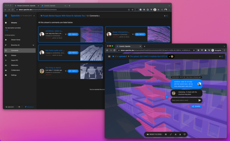
Speckle
Speckle functions as an open-source data exchange platform specifically for BIM (Building Information Modeling) data. It allows various 3D modeling applications to connect and share information seamlessly**. This improves collaboration between architects, engineers, and other AEC (Architecture, Engineering, and Construction) professionals by eliminating data silos and ensuring everyone works with the latest information throughout a project lifecycle.

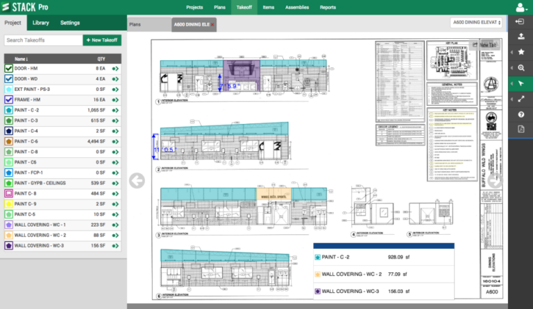
STACK
STACK is a cloud-based construction software platform that streamlines the entire construction process, from preconstruction to project completion. It offers a comprehensive suite of tools, including takeoff and estimating software for accurate bidding, project management tools for scheduling, budgeting, and resource allocation, and field collaboration tools for real-time communication and document sharing.
By integrating these functionalities into a single platform, STACK helps contractors improve efficiency, enhance collaboration among teams, reduce errors, and ultimately boost their bottom line. Its cloud-based nature allows for accessibility from anywhere, and integrations with other popular construction software further enhance its utility.
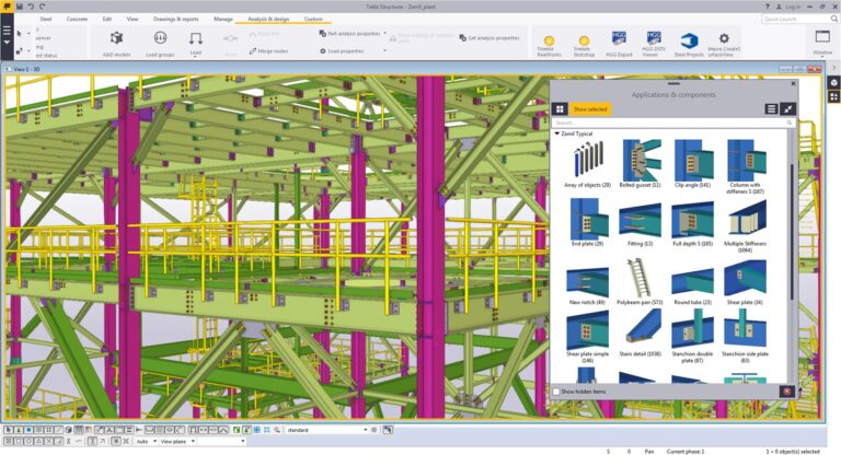
Tekla Structures
Tekla Structures is widely used for creating detailed 3D models of buildings, bridges, and other structures. It provides tools for structural analysis, design, and detailing, enabling engineers to model complex structures with accuracy and efficiency. Tekla Structures supports various materials, including steel, concrete, and timber, and facilitates collaboration among project stakeholders through interoperability with other software platforms.
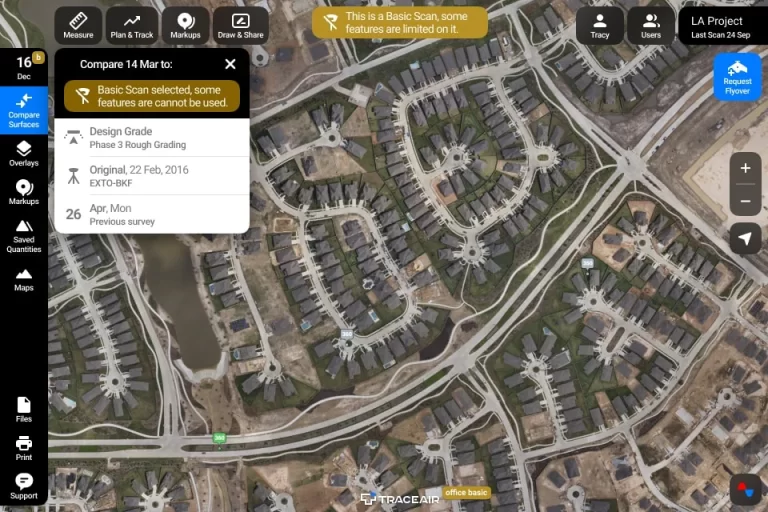
TraceAir
TraceAir is a construction site analysis and management platform that leverages drone data to simplify workflows and enhance project efficiency. The platform enables drone surveys to create accurate 3D topographical models of the site. Users can then overlay design documentation to compare as-built conditions with the intended design, track earthwork progress using cut/fill calculations, visualize stockpiles, manage site logistics, and collaborate easily with project stakeholders, all from a centralized web-based platform.

Up.Codes
UpCodes is a platform that provides building code compliance solutions for the construction industry. It offers tools and resources to help architects, engineers, contractors, and other professionals navigate and comply with building codes and regulations more efficiently.

Vercator
Vercator is a cloud platform to quickly process your point cloud data.
Vercator’s registration service automatically aligns point cloud data without artificial scan targets. Powerful, fast and interoperable, register large, complex point cloud data with minimal intervention, saving you valuable time and resources.
Vercator classification extracts automated insight from point cloud data by separating data into different classes of interest and individual instances. This allows insight into assets in your scene allowing for quick understanding and data extraction for downstream modelling
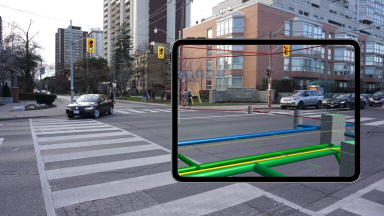
vGIS
vGIS is a software company that provides an augmented reality (AR) platform designed for the AEC (Architecture, Engineering, Construction) industry and utilities sectors.expand_more Their platform seamlessly integrates 2D GIS, 3D BIM, and reality capture data into a unified AR environment.expand_more This allows users to visualize complex designs, infrastructure models, and as-built data overlaid onto the real world with centimeter-level accuracy.expand_more vGIS aims to streamline decision-making, improve coordination, reduce errors on-site, and enhance communication between stakeholders throughout the project lifecycle.expand_more