


Filter by Vendor
 AirSquire.AIAirSquire.AI 1
 AllplanAllplan 1
 AngulerisAnguleris 1
 ArchistarArchistar 1
- Arkdesign 1
- Arkio 1
 AuginAugin 1
 AurivusAurivus 1
 AutodeskAutodesk 3
- Blueprints-AI 1
 CatendaCatenda 1
 CodeComply.AICodeComply.AI 1
 Cove.ToolCove.Tool 1
 CupixCupix 1
- Darf Design 1
 DBFDBF 1
- Fologram 1
 Gamma ARGamma AR 1
- GraphiSoft 2
 Green BadgerGreen Badger 1
 IGS GroupIGS Group 1
 ImersoImerso 1
- Inspect.Mind 1
 KreoKreo 1
 OracleOracle 1
 Procore TechnologiesProcore Technologies 1
 ProjectReadyProjectReady 1
 ReviztoRevizto 1
 SpeckleSpeckle 1
 StreamBIMStreamBIM 1
- Trimble Inc. 3
 UpCodesUpCodes 1
 VercatorVercator 1
- vGIS 1
 Vu.CityVu.City 1
Featured


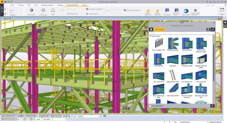
Tekla Structures
Tekla Structures is widely used for creating detailed 3D models of buildings, bridges, and other structures. It provides tools for structural analysis, design, and detailing, enabling engineers to model complex structures with accuracy and efficiency. Tekla Structures supports various materials, including steel, concrete, and timber, and facilitates collaboration among project stakeholders through interoperability with other software platforms.
TraceAir
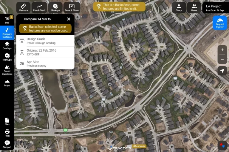
TraceAir is a construction site analysis and management platform that leverages drone data to simplify workflows and enhance project efficiency. The platform enables drone surveys to create accurate 3D topographical models of the site. Users can then overlay design documentation to compare as-built conditions with the intended design, track earthwork progress using cut/fill calculations, visualize stockpiles, manage site logistics, and collaborate easily with project stakeholders, all from a centralized web-based platform.
twinworx
TwinWorx is a software platform from e-Magic that creates 3D digital twins of facilities by integrating building data with sensor information. These digital twins allow companies to monitor, visualize, control, and optimize their assets, leading to increased efficiency, better decision-making, and improved operational outcomes across various industries like manufacturing, healthcare, and building management.


Vercator
Vercator is a cloud platform to quickly process your point cloud data.
Vercator’s registration service automatically aligns point cloud data without artificial scan targets. Powerful, fast and interoperable, register large, complex point cloud data with minimal intervention, saving you valuable time and resources.
Vercator classification extracts automated insight from point cloud data by separating data into different classes of interest and individual instances. This allows insight into assets in your scene allowing for quick understanding and data extraction for downstream modelling
VERT
VERT is a tool used to measure and reduce carbon emissions in construction projects. It allows users to analyze whole life carbon emissions, compare design options, and make informed decisions to minimize environmental impact.
VERT can be used by property investors, design teams, sustainability professionals, and educators.
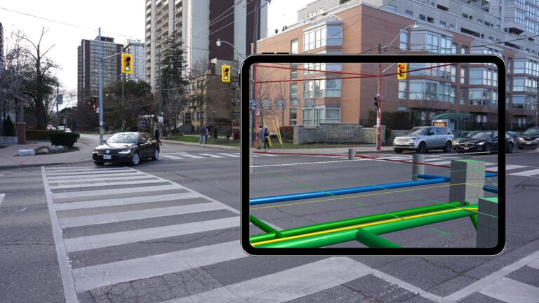
vGIS
vGIS is a software company that provides an augmented reality (AR) platform designed for the AEC (Architecture, Engineering, Construction) industry and utilities sectors.expand_more Their platform seamlessly integrates 2D GIS, 3D BIM, and reality capture data into a unified AR environment.expand_more This allows users to visualize complex designs, infrastructure models, and as-built data overlaid onto the real world with centimeter-level accuracy.expand_more vGIS aims to streamline decision-making, improve coordination, reduce errors on-site, and enhance communication between stakeholders throughout the project lifecycle.expand_more